Marine litter is a recognized and major aspect of marine pollution, posing a direct threat to marine organisms and raising a global concern for its environmental and economic implications. Floating Marine Macro Litter (FMML) is the portion of marine litter comprising items larger than 2.5 cm that float in the surface layers of the water column and is considered a pertinent direct indicator of the pressure exerted by marine litter on marine ecosystems. [Monitoring of Floating Marine Macro Litter, JRC Technical Report]
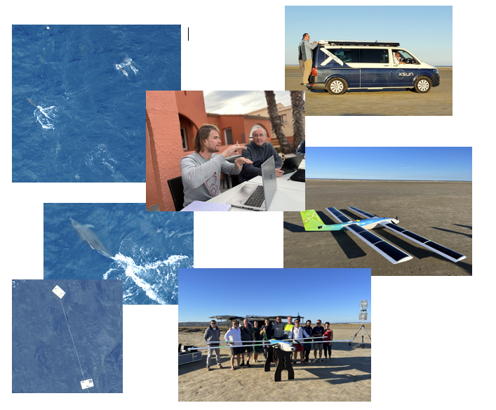
Main goal of the project was to provide very high-resolution image data on marine litter in the Mediterranean Sea to develop optimal methods for FMML mapping in future. Also, methods for mammal images, birds and in general imaging the biodiversity of the Golfe du Lion were important. Drone and satellite data were acquired and will be used for further analysis on detection and statistics. Optimization was done based on sample data in the sea.
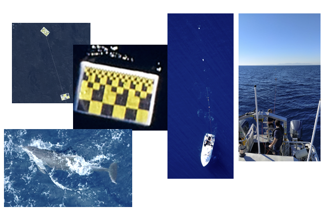
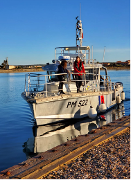
Close working with the JRC to XSun optimize the flight plan. European Space Imaging provided excellent MAXAR satellite data – just on the day and time of the mission. Parc naturel marin Golfe du Lion provided the ship to lay out the samples into the sea.
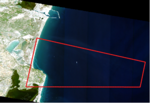
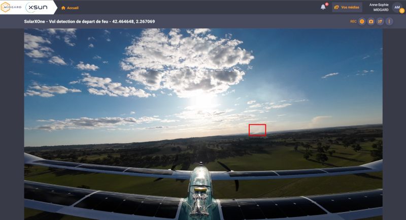
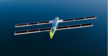
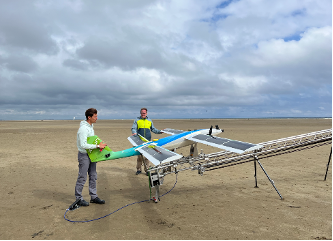
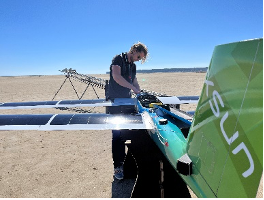
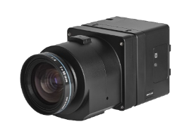
XSun successfully planned, organized and executed the flight mission. The flights were executed on two flight days and with SolarXOne flights equipped with a PhaseOne 100Mpxl camera. The flights were launched from Leucate and conducted over the open ocean up to 25 km away from the coastline.
The flights were executed on two days with different light, wind and wave conditions. Different altitudes from 80 to 400m were tested. The PhaseOne 100Mpxl camera was flown with two different lenses: 80mm and 35mm.
In total the SolarXOne flew 12h and 27 minutes and made a total ground distance of 724km.
With a 500m maximum swath from 400m this corresponds to 362km2 area coverage.
Brilliant demonstration on open sea and coastline monitoring with SolarXOne. Demonstration on operations in different environmental conditions.
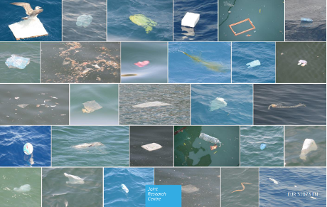
Solid data set for statistical and optimization analysis. More than 13.500 images in different altitudes, sensor parameters, wind and light conditions.
Demonstration of long-distance monitoring (up to 25km into the open ocean).
Long endurance demonstration. More than 12h airtime in 2 days despite windy and cloudy conditions on the second day.
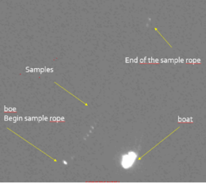
Sample detection (up to 0.4 cm resolution) from 80 to 400 m altitude.
Mammal detection from 80 to 400m altitude.
Excellent co-operation between JRC, Parc naturel marine Golf du Lion, European Space Imaging and XSun.
“Goals Overachieved”, Dr. Georg Hanke, JRC.