SolarXOne has the capability to fly Beyond Visual Line of Sight to perform Area mapping and Corridor mapping
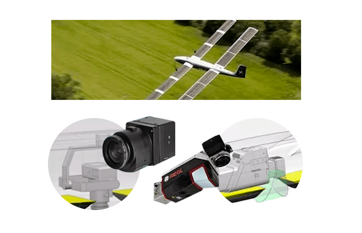
Aerial Imaging and LiDAR
Using the best sensors, mapping the surface of the Earth can be performed at very high photographic resolution as well as LiDAR high point density over large areas where other UAVs can't deliver
Aerial Imaging and LiDAR
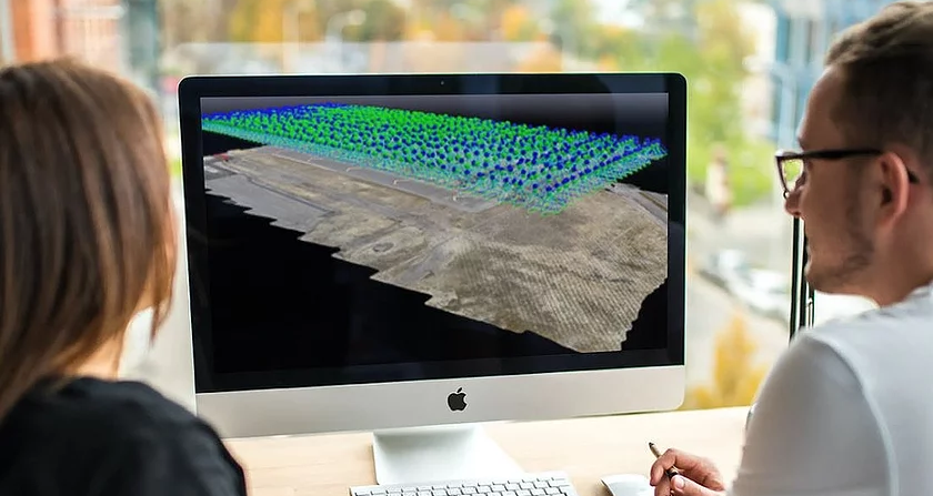
Once the flight plan has been created, the UAV will fly autonomously to cover the project using the preset parameters. The captured data will be downloaded for post-processing after completion of the flight mission.
Depending on the application, the UAV can accommodate the right camera for the job. From small to medium format cameras, RGB, IR , NIR or multispectral, all are installed on gyro-stabilised mounts for nadir capture and optimised coverage density of LiDAR points and characteristics of the pulse return are defining which sensor is suitable for your project. We can recommend which is the best system for your application
Corridor Mapping
Precise navigation over hundreds of kilometres, autonomously
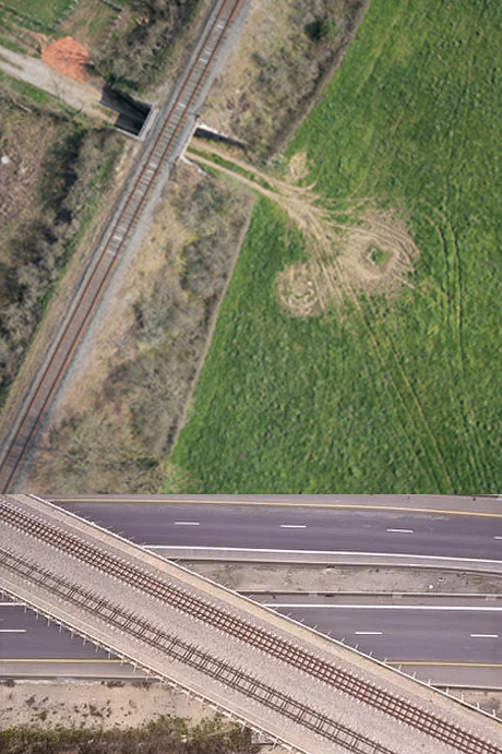
Our UAV solution is the perfect tool for mapping very long linear projects and/or complex ones where other UAVs cannot deliver because of the lack of endurance and payload capacity. Our UAV can fly over very long distances with a precise navigation system.
Tasking your corridor mapping project has never been simpler thanks to the long range of our UAV. This equates in lower costs of operation for maximum quality aerial data acquisition.
Think about it... 12 hours of flying autonomy...
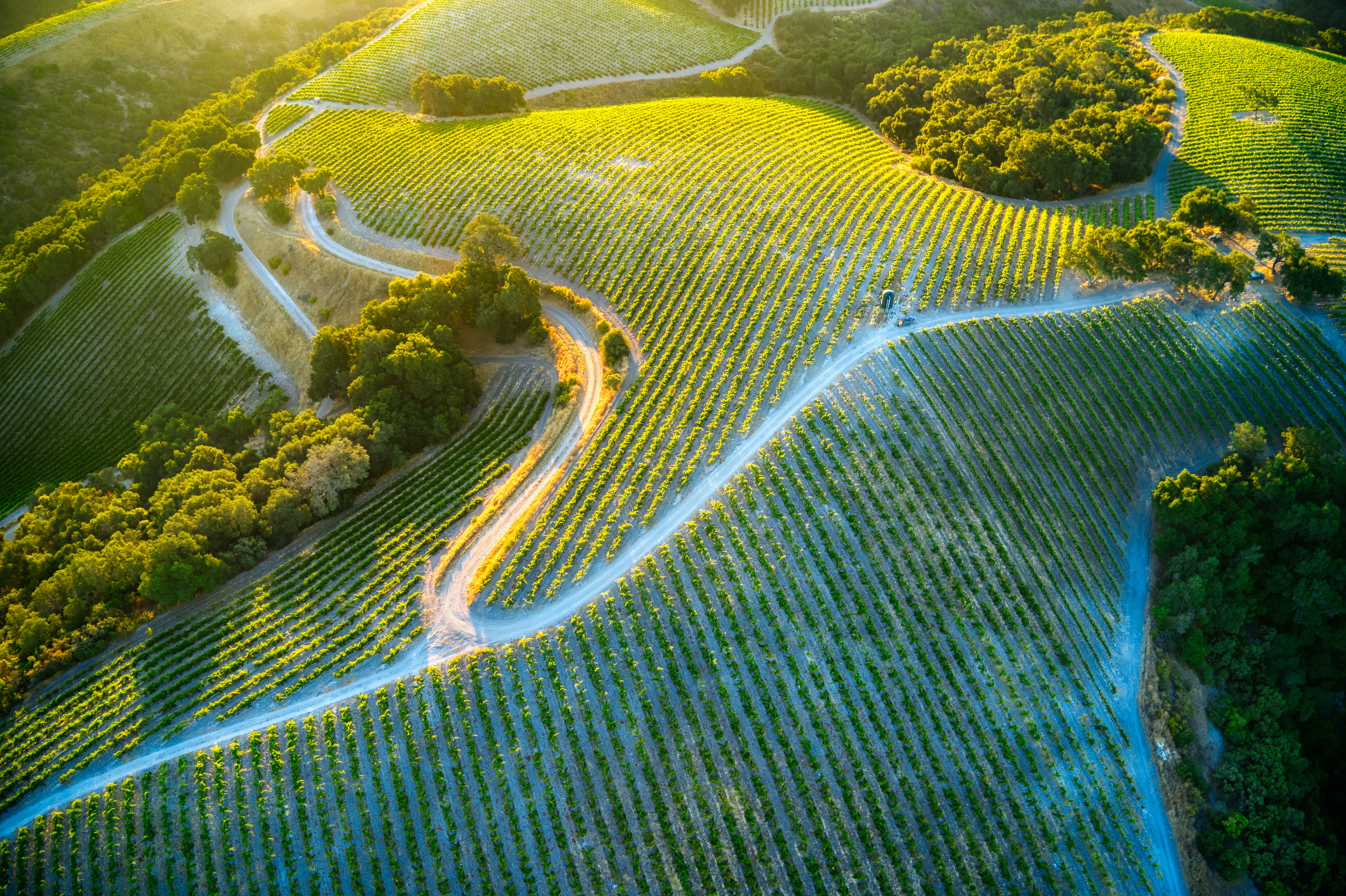
Super high resolution imagery, down to 1 cm GSD and even lower, offers great detail for all type of analysis. Not only is the information extremely valuable in terms of interpretation and inspection, but also in terms of planimetric and altimetric accuracy.
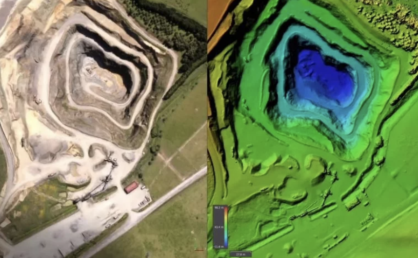
The high resolution imagery and/or the LiDAR data captured from our UAV can be processed to obtain DTMs and DSMs.
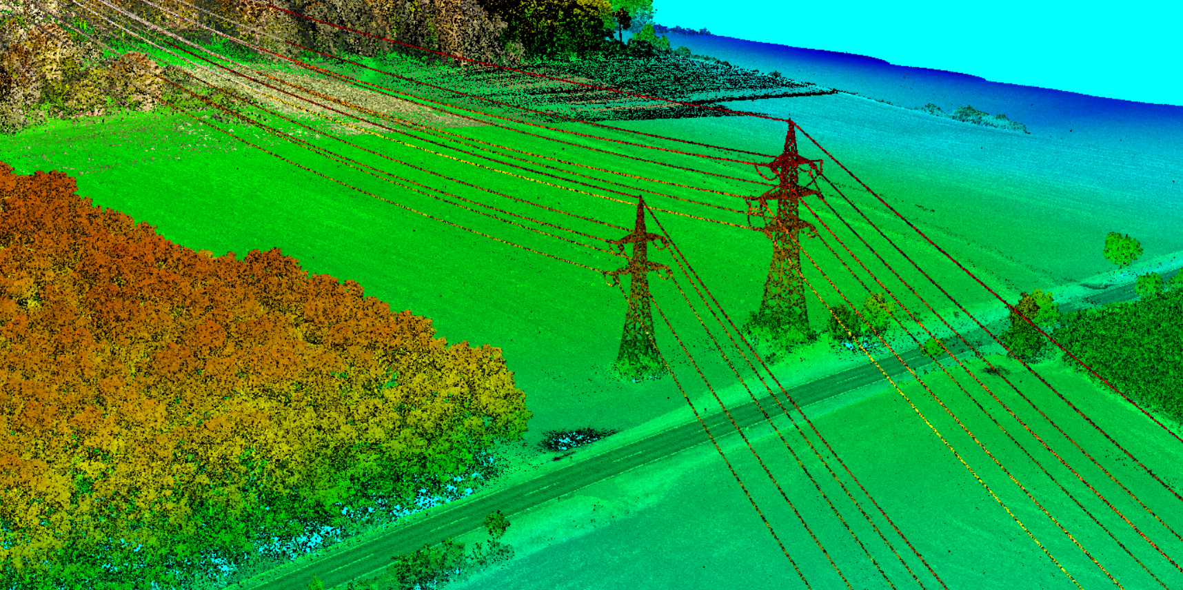
These models can be used for powerlines, railroads, roads, pipeline planning and survey. Other applications includes coastal and river erosion studies, flood analysis, obstructions evaluation for telecoms and aviation
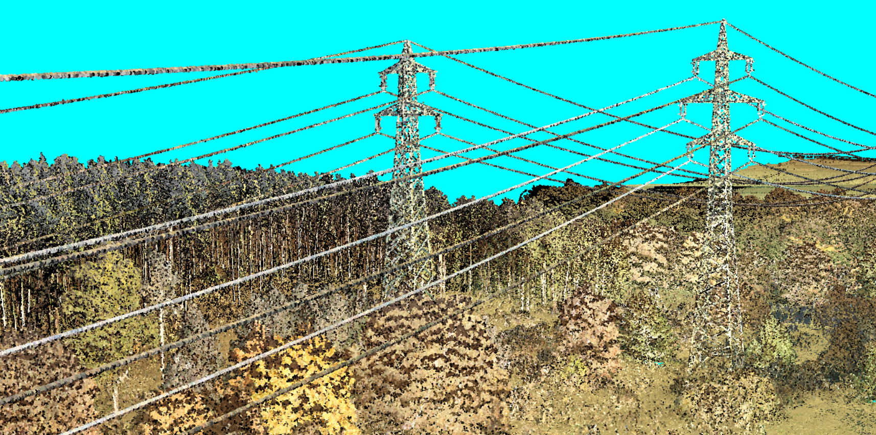
LIDAR image with our VUX120 at 40pts/m² of powerlines
Coverage and performance
With an entire day of effective aerial survey capability in a single flight sortie, our UAV can cover large areas when using the right camera and lens combination for a given image ground resolution. State-of-the-art digital cameras for photogrammetry can achieve tremendous geometric accuracy as it is specifically designed for mapping projects.
Coupled with a gyro-stabilised mount, the system ensures image overlap consistency and perfect nadir photography for efficient aerial acquisition. Its high dynamic range can enhance details in shadows and in highlights areas whether in RGB or NIR.
- AGISOFT / METASHAPE - Photogrammetric restitution - Precise cartography / resolution up to 5mm - Editing and classifying point clouds - Digital Elevation Model : DTM/DSM generation and export - Georeferenced orthomosaic generation and edition - Automatic powerline detection - Multispectral images processing - Cloud based calculation and data export with AWS - Powerful calculation capability : Workstation PULSARON 24x 3.8 GHz / 256-GB RAM / 500-GB NVMe SSD & 16-TB RAID-0 NVMe SSDs / NVIDIA RTX A5000 + 90-TB RAID-Level-5
Download all information about Mapping application